The Litton House and Lands
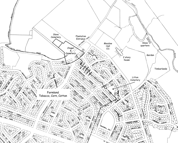
The following map is based on one drawn by a decendant in the 1950s. It has been superimposed on a map of the area from the 1960s. Placement of colonial features is as close as I can figure based on the data I have. The location of the house is guesswork. The little information I have regarding the house states that it had a "Viewing Room" out the back. My thinking is that the best view would be down the hill to the creek, leaving the flatter land in front as formal lawn and farming area. - DS

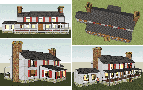
The following pictures of the house are based on the little written discription I could find, a rough floorplan, a xerographic copy of a drawing of a painting, and my meager knowledge of colonial architecture. I would love to say it's an accurate rendition, but that would be a fib.
The house would have started as a core and been added to over the years. The pictures below represent a later stage of the home's evolution. Access to the kitchen would have been through a doorway in the back rather than through the house while the chimney between the two would have been two sided, one for the kitchen and the other for the house.
The house stood until the 1930s when, after years of empty decay, it was finally torn down.

These pictures were created using Google Sketchpad. - DS
