

The students of the Global Ecology Studies Program hike many different trails every year. These trails are always different from one another and always entail different activities. For our senior project, we (Nicole Kirchoff and Matt Fultz) worked together to create interactive maps of five of the trails that Global students hike. To map these trails, we took gps points at interesting parts along the trail. At these points, we also took a picture of the interesting part of the trail. Then, using Google Earth and Google Maps, we connected the pictures to the GPS points and mapped the GPS points on Google Maps. These trail maps allow people to view the types of trails that students will hike in the Global Ecology Studies Program. Also, it allows people, GESP students or not, to view these trails without having to physically visit the trails. We hiked trails that Global students hike in Junior and Senior Year. We hiked and mapped a section of Seneca Creek Trail, two different sections of Little Bennett Trails, Billy Goat Trail A, and Billy Goat Trail B. The interactive maps are quite easy to use. TO view the images at the GPS coordinates, click on the different icons. Each icon is located at the correct GPS point and once the icon is clicked upon, a small box will appear containing the coordinates of that point, the image taken at that point, and also a small description or explanation of the image. To move the map you click the mouse over the map, hold down the mouse and drag and drop wherever you want the map to go. To zoom in on the map, double click with the left hand mouse button. To zoom out, double click with the right hand mouse button. You can also zoom in or out using the + or - buttons on left hand side of the screen.
Seneca Creek Trail is hiked by Global students in 11th grade for a combination of activities including physics calculations and a hunter gatherer simulation for AP World History. The portion that is hiked by GESP students is a portion of the trail that connects route 28 to Berryville road. However, the trail is 4.4 miles long so there is not enough time to hike the entire trail during the hike. We decided to hike the entire trail so that the entire section of the trail would be mapped not only a portion of it. The trail follow Seneca Creek for most of its length and contains a large variety of fauna and flora.
View Seneca Creek Trail in a larger map
Global Students hike a section of the Kingsley Trail during Senior Year. The Global students go on this field trip to gather soil at different elevations so that these soils can be tested to see if the soil is different at different elevations of a slope. Instead of hiking up Kingsley Trail and then back down Kingsley Trail, we decided to make a loop and continue on to Purdum Trail which then connects to Logger's Trail, which eventually leads back to the parking lot. There is a Schoolhouse named "Kingsley Schoolhouse" at the end of Kingsley Trail. The Kingsley trail, Purdum trail, and Logger's trail all connect to one another and form a loop that is about 2.4 miles long. This loop contains a large variety of flora and passes by many streams.
View Little Bennett: Kingsley/Purdum/Logger's in a larger map
This section of Little Bennett is hiked in the Senior year of Global Ecology. The students walk up a portion of Western Piedmont trail and collect data so that the students can calculate the carrying capacity of squirrels within their section of the woods. We decided, like with the other section of Little Bennett, to use other trails that connected to make a loop. We hiked the Dark Branch, Pine Grove, and Western Piedmont sections of the trails. Together they create a loop of trails that is about 2.5 miles long. This loop contains many interesting features including a ford, meaning that a stream that crosses directly over the trail and has to be crossed.
View Little Bennett: Dark Branch/Pine Grove/Western Piedmont in a larger map
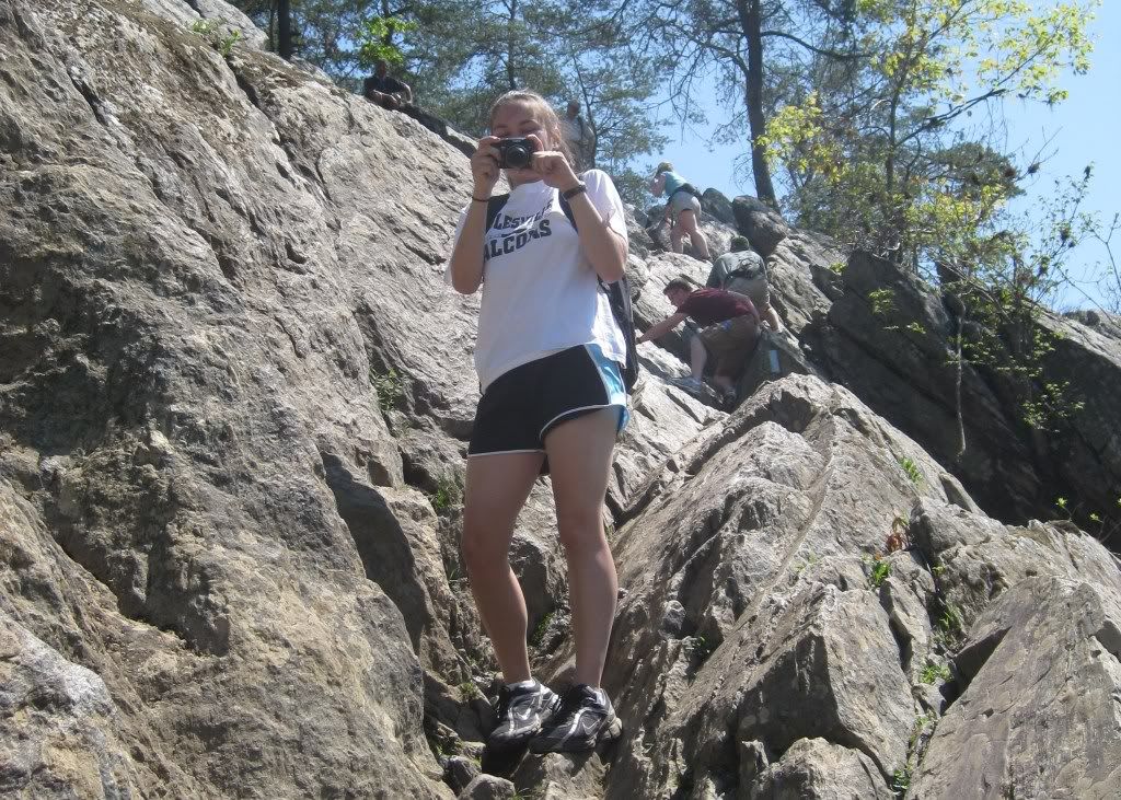
Global students hike Billy Goat Trail A during their senior year. This hike did not have an accompying lab or activity, besides the global journal. This trip was primarily for recreational purposes, but included some aspects of the AP Environmental Science class, including geology. The sights along this trail are quite remarkable. Billy Goat Trail A is the first Billy Goat Trail along the C & O Canal. It is the most challenging of the three and includes a lot of large rocks and a steep rock cliff. There are many breathtaking views of the river and the cliffs on the opposite side.
View Billy Goat Trail A in a larger map
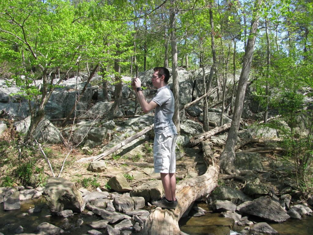
The Global class never actually hiked Billy Goat Trail B. However, we decided to hike this trail because when we first came to Great Falls National Park in order to Hike Billy Goat Trail A, Billy Goat Trail A was closed. So instead of going home we decided to hike Billy Goat Trail B and allow people to see what the other, less popular Billy Goat Trail is like. Billy Goat Trail B is farther along the C & O Canal than Billy Goat Trail A. Billy Goat Trail B is also less challenging than Billy Goat Trail A, but is still relatively difficult. There are some parts with large rocks and the trail always has a good view of the potomac river. There is a lot of wildlife along the trail including birds, butterflies, and many other types of fauna and flora.
View Billy Goat Trail B in a larger map